
Google Earth Explorations: 49 Unusual Things Seen From Above
For the past two decades, Google Earth has been giving people all over the world a peek into our planet that we never had before. In a matter of seconds, you can virtually transport yourself to a quiet street in Sweden or the house you grew up in hundreds of miles away. It’s amazing to be able to check out locations we may never have the chance to visit in person!
And if you think these interactive maps are boring, you’ve clearly never taken a trip to the Google Earth, Structures and Anomalies Facebook group. This community is dedicated to capturing the strangest and most amusing sights people have spotted while perusing Google Earth. So enjoy scrolling through these unexpected images, and be sure to upvote the ones that inspire you to take a virtual stroll through a foreign city!
Click here & follow us for more lists, facts, and stories.
#1 Guys Guess What I Found This On Google Earth Totally Cool
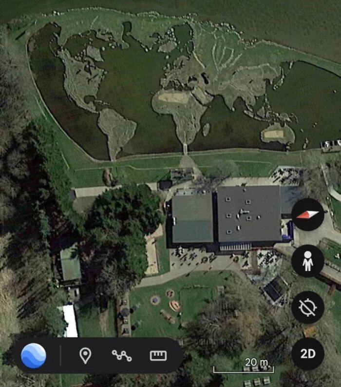
© Photo: Shalu Kumari
#2 My Sister Sent This One To Me. This Is One Of My Faves
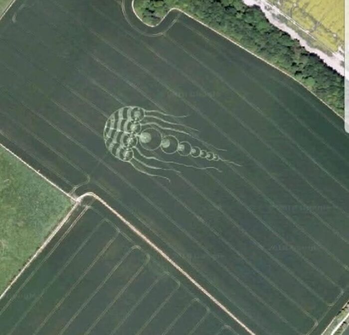
© Photo: James Raid
#3 Rabbit
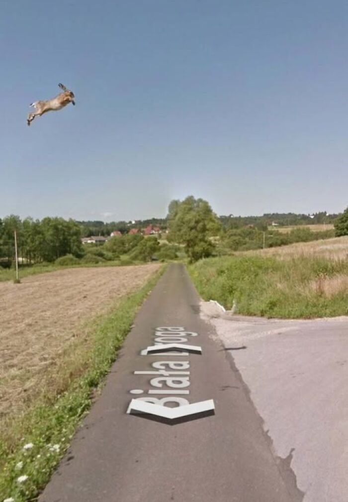
© Photo: Novita Sarii
The Google Earth, Structures and Anomalies Facebook group has only been around since 2020, but in 5 short years, it has amassed an impressive 2.4 million members. According to the group’s description, the community “is for anyone who loves looking on Google Earth and has found strange structures, anomalies or something that can't be explained, as well as anything from Google Earth you found interesting.”
And clearly, there are plenty of fascinating sights on the platform! From bunnies flying through the air to structures that look like they were created by aliens, people never seem to run out of Google Earth images to screenshot. And who knows, maybe there’s something worth sharing hidden in your very own neighborhood too!
#4 Found On Google Earth Page In Russia. Looks Like Giants Walking Up The Hill
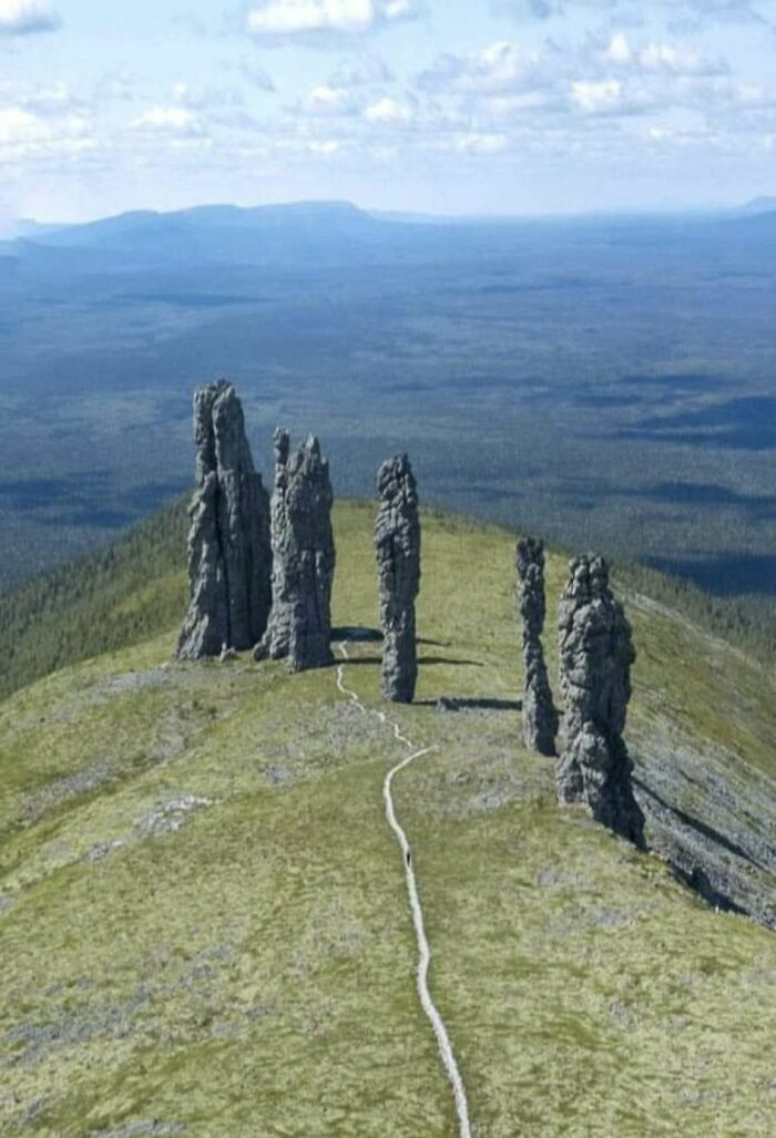
© Photo: Emmie Lee
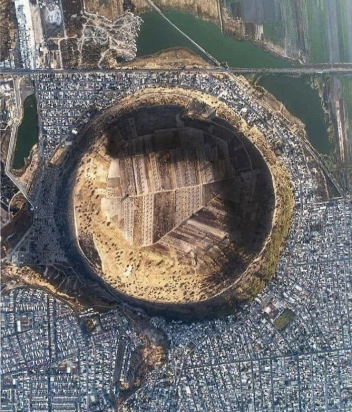
#5 The City Of Xico In Mexico, Surrounds A Large Volcanic Crater. Known As 'Cerro De Xico', Or “Hill Of Xico”
The 1-kilometer-wide crater provides fertile soil and naturally protected farmland amid the ever-advancing sprawl of Mexico City.
© Photo: Ummu Aqillah Sriwahyuni
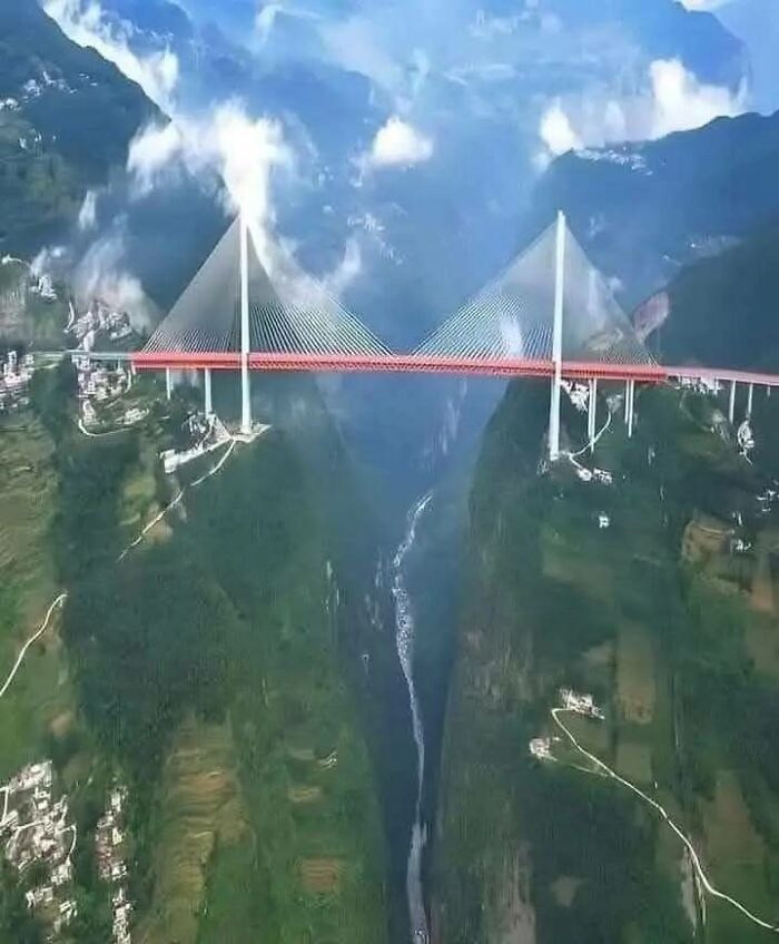
#6 The Baluarte Bridge Is A Suspension Bridge Located In The State Of Durango, Mexico
It was inaugurated in 2012 and at that time was the tallest suspension bridge in the world, with a height of 403 meters over the Baluarte River. Construction of the bridge began in 2008 and took approximately 4 years to complete. It was designed by the Italian engineer Riccardo Morandi and built by the Mexican company Tradeco. The bridge has a total length of 1,124 meters and connects the states of Durango and Sinaloa, significantly reducing travel time between the two regions.
© Photo: Shalu Kumari
If you haven’t spent much time scrolling (or virtually strolling) through Google Earth, you might not know much about the platform. So we’ve got some fun facts to share about it from Facts.UK. First, they note that Google Earth relies on satellite imagery to bring us images of the world. This is part of the reason why it feels so immersive to “visit” somewhere new through this virtual lens.
It’s also pretty impressive how much of the planet Google Earth has managed to cover. If you’ve ever seen those little cars with cameras on top driving around, you might even be featured on some maps! Apparently, over the past 25 years, the platform has photographed 97% of Earth. And perhaps, over time, they’ll manage to cover that last 3% as well.
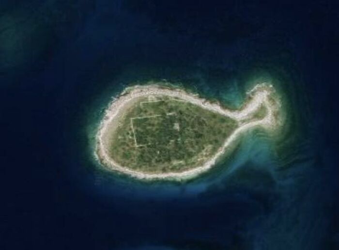
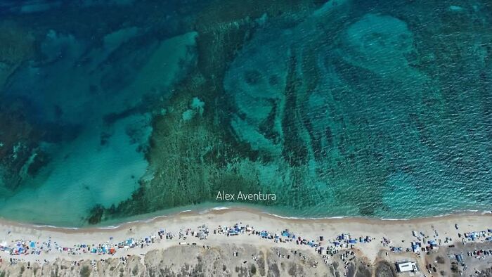
#7 Plenty Of Fish In The Sea
© Photo: Dane McCormack
#8 Spotted Lake, Canada: A Lake That Evaporates In The Summer, Leaving Small Mineral Pools Of Different Colors, Creating A Unique Landscape

© Photo: Jacob Albert
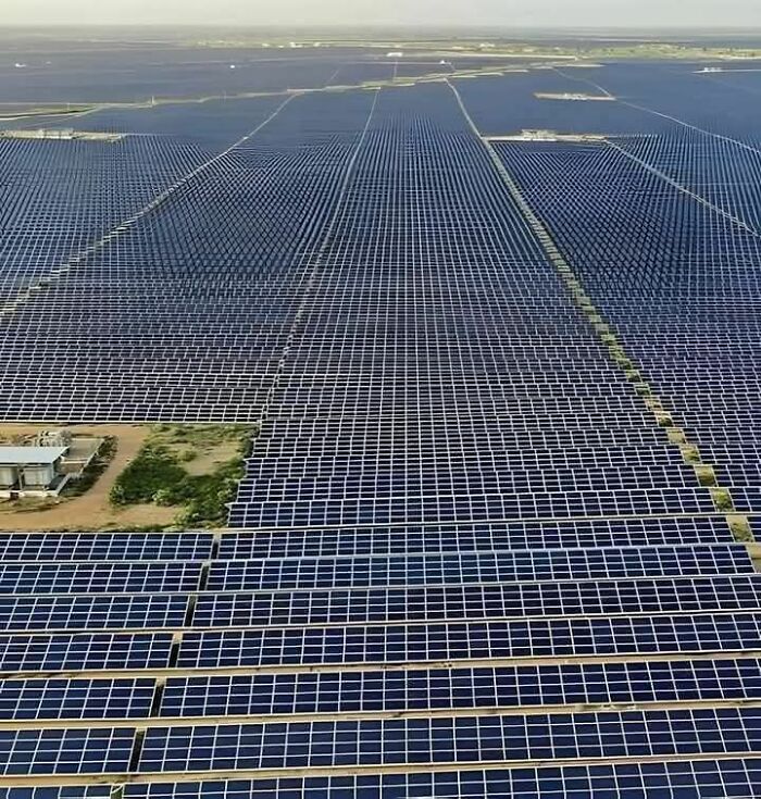
#9 The Largest Renewable Energy Park In The World Is Located In Khavda, Gujarat, India, And Is An Amazing Achievement In The Field Of Sustainable Energy
© Photo: Babah Hanan Hanaa
Did you know that Google Earth also extends beyond our own planet? Despite the platform’s name, users can actually go into space and explore parts of other planets and moons. Of course, the satellite images are still taken from quite a long distance away. But it’s fascinating to be able to view space from the very same platform that you might use to check out a new coffee shop in your area on a Saturday morning!
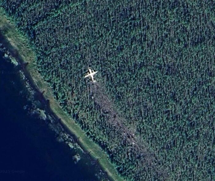
#10 Plane Crash In Northern Russia
© Photo: Shalu Kumari
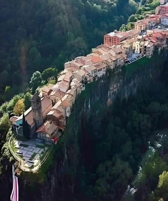
#11 Castellfollit De La Roca 42°13′17″n 2°33′3″e Is A Municipality In The Comarca Of Garrotxa, In The Province Of Girona, Picturesque Village In Catalonia, Spain
Perched dramatically atop a 50-meter-high basalt cliff formed by ancient volcanic eruptions. With origins dating back to the 10th century, this medieval village played a crucial role in regional conflicts due to its defensible position. The charming streets and traditional stone houses, along with the 13th-century Church of Sant Salvador, reflect its rich history. Castellfollit de la Roca attracts visitors from around the world with its stunning views and unique geological formation.
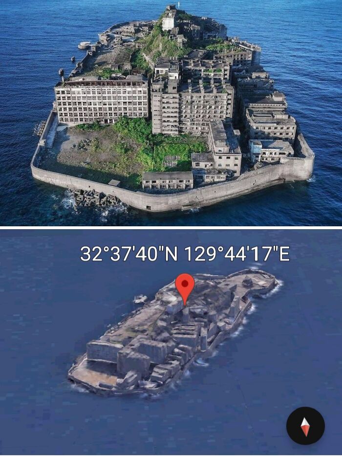
#12 In The Waters Of Nagasaki Prefecture, Japan, There Is An Island That Looks Rundown And Messy
Although there are many tall buildings there, there is not a single inhabitant. The island is Hashima Island. Hashima Island is also often referred to by locals as Gunkajima Island. The island grew in popularity after its story and location were made into a feature film. Before its popularity as a ‘haunted island’, Hashima Island originally served as an undersea mining operation and a silent witness to Japan's rapid industrialisation in the 1890s. Not only were there mines and factories, but there were also residential neighbourhoods. The availability of jobs led to more and more people settling on the island. By the 1950s, the population had swelled to as many as 5,000. But as coal power was replaced by petrol, coal prices fell, and many mines, including those on Hashima Island, were permanently closed. By 1975 the island was completely empty after being abandoned by its inhabitants. 32°37'4"N 129°44'17"E
© Photo: Nicholas Ackerley
Google Earth is actually so popular that it has even inspired a game called GeoGuessr. Players can see images of random places around the globe and try to guess exactly where on the planet they might be. You can make it easier for yourself by strictly sticking to European capitals, or you can choose an entire country and try to locate random roads within Lithuania or Kazakhstan. If you’re a fan of going on virtual Google Earth vacations, you’ll certainly get a kick out of GeoGuessr.
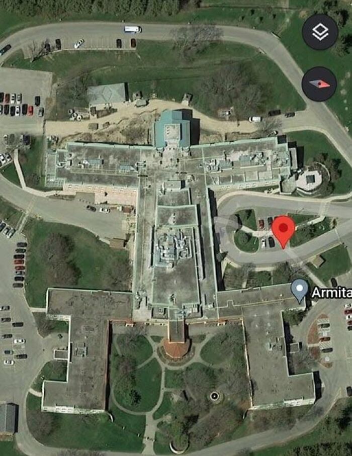
#13 A Building By My Hometown... Looks Like A Person. A Guy I Think
© Photo: Takeo Kun
#14 Sketchiest Ice Cream Truck I've Ever Seen!
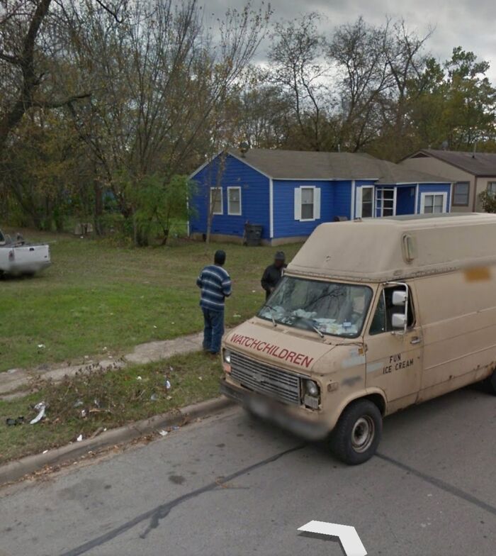
© Photo: Edith Elder
#15 Found Where I Should Have Been Born
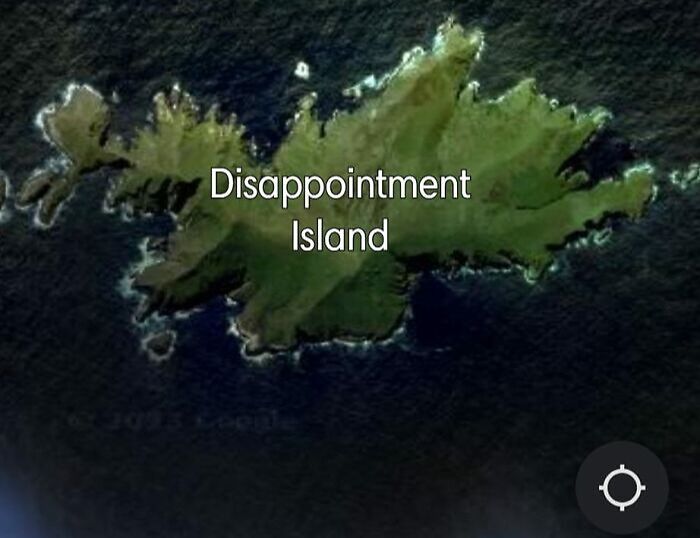
© Photo: Swarup Biswas
Now, this may sound unconventional, but some companies have even taken advantage of the popularity of Google Earth to advertise on it. In fact, in Nevada, there was once an 87,500 square-foot image of KFC’s Colonel Sanders that could be seen from space. And the world’s largest Coca-Cola logo can be seen at 18.5292 S, 70.2500 W on the side of a hill in Chile. It really is impossible to escape advertising these days!
#16 Everyone Wants To Fit In ! Antarctica
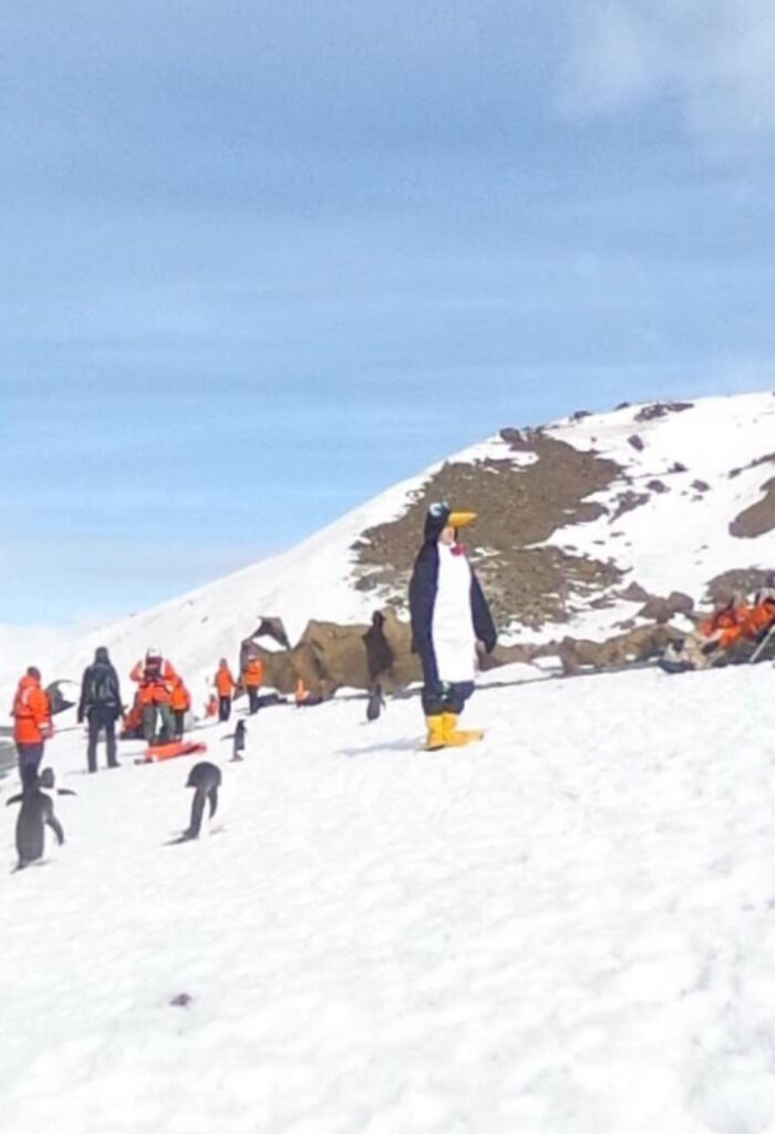
© Photo: Anonymous participant
#17 Google Earth Has Begun Updating Images Of Gaza Before And After
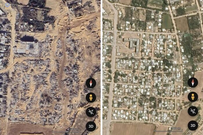
© Photo: Jon Renan
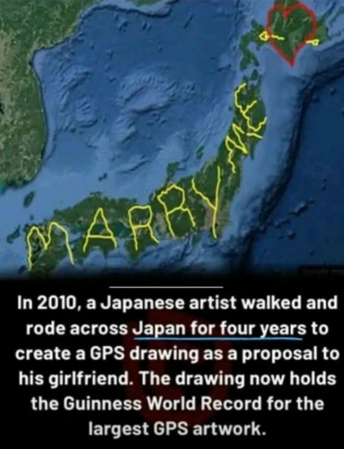
#18 A Japanese Man Rode Over 4,000 Miles To Spell "Marry Me" On Google Earth:
Tokyo resident Yasushi “Yassan” Takahashi used GPS technology to propose to his girlfriend. Inspired by GPS art, where digital drawings are created by traveling preplanned routes with a GPS device, Yassan spent months meticulously planning a journey across Japan using Google Earth. His goal: to spell out the words “Marry Me” across the country. Quitting his job and setting off in June, Yassan traveled 4,451 miles from Hokkaido to Kagoshima over six months, documenting his path. When uploaded to Google Earth, the massive "Marry Me" message was revealed, earning him a Guinness World Record for the largest GPS drawing in history. Today, GPS art has become a global phenomenon, combining creativity, travel, and technology to transform landscapes into canvases for drawings as varied as animals, fictional characters, and intricate designs.
© Photo: Momy Amel
Another oddity that has been spotted on Google Earth was a strange triangle dotted with bright lights that appeared in 2007 in the middle of a field in Australia. Some people were quick to claim that it must be a UFO or of extraterrestrial origin, but others believed there must have been a simpler explanation, noting that it could be associated with a nearby wind farm. Either way, it can no longer be seen on Google Earth today.
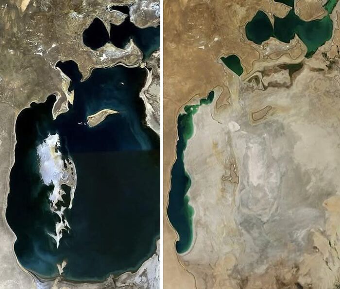
#19 Crazy How The Aral Sea Got Drained So Much.wow
© Photo: Angelica Danhagen
#20 Omg
© Photo: Ella Fazila
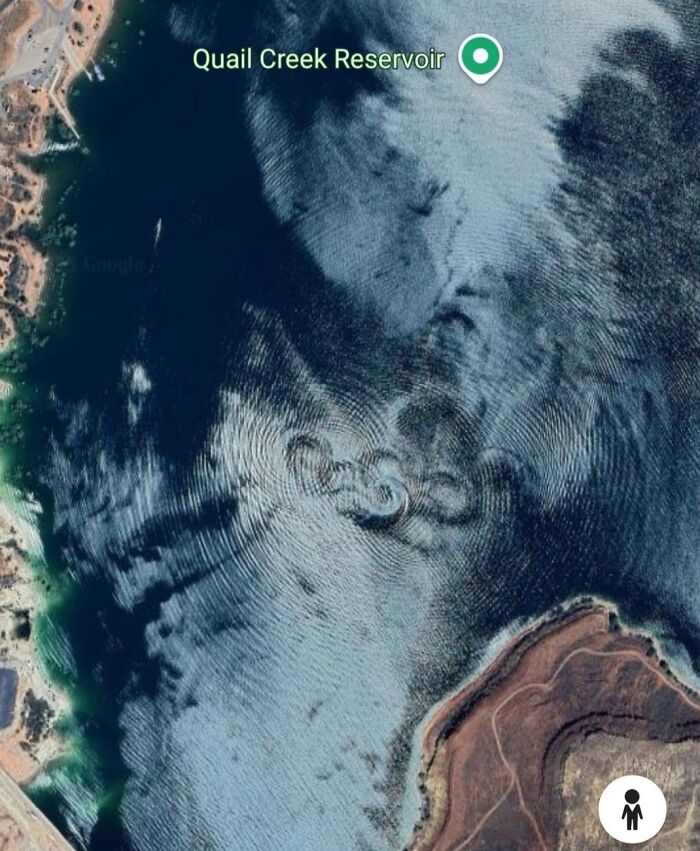
#21 What In The Loch Ness Monster s*** Is Going On In Utah
© Photo: Greg Hill
It’s impossible to travel around the entire world. In fact, nearly a quarter of Americans have never even traveled outside of the United States. But going abroad is expensive and simply inaccessible to a lot of people. So if you’re curious about the world, exploring through Google Earth can be a great alternative! And you might even be able to help solve some crimes while you’re at it.
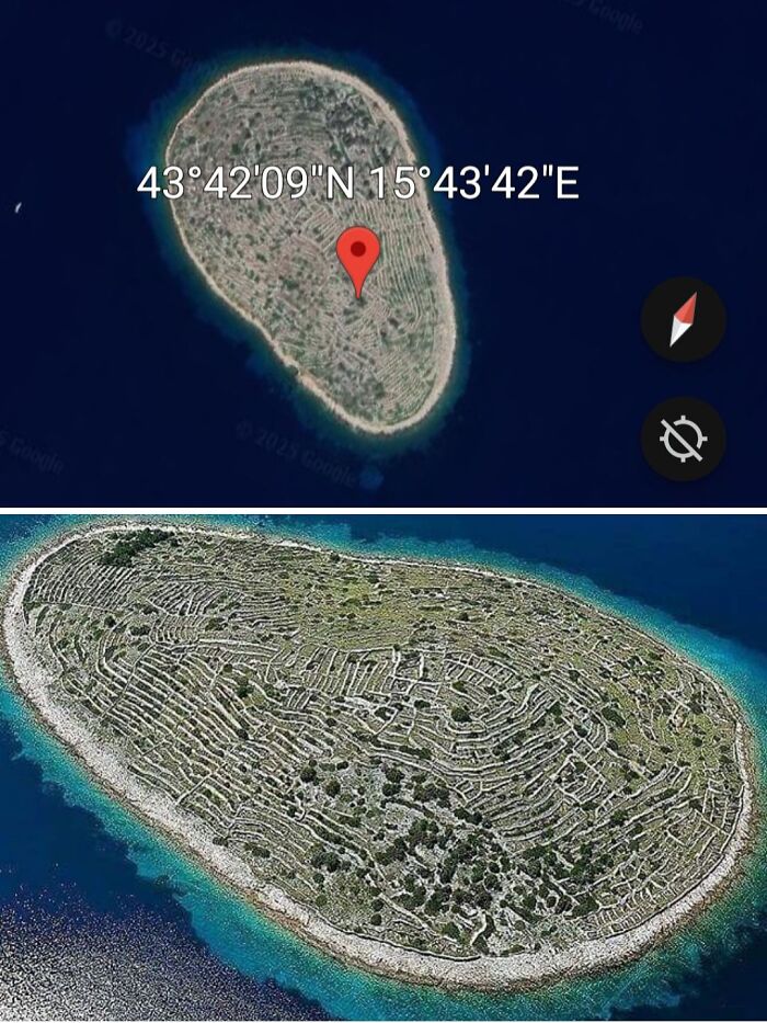
#22 Baljenac Island, A Unique Island In Croatian Waters, Stretches Around The Adriatic Sea, A Sea That Separates Italy And The Balkans
Uniquely, this small 14-hectare island, when viewed from above, resembles a fingerprint with its distinctive strokes and curves. The fingerprint-like lines embedded on this uninhabited island are actually artefacts of stone walls surrounded by trees. The stone walls, which stretch for 23 kilometres, mark the boundaries of each plantation.
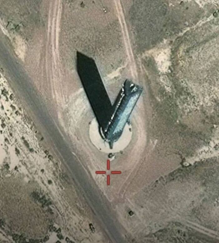
#23 Tall Triangle Shaped Tower At Area 51
© Photo: Shalu Kumari
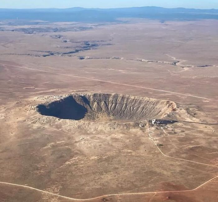
#24 Meteor Crater And Barringer Space Museum Near Winslow, Arizona
© Photo: Amberia
We hope you’re enjoying this scroll through some of Google Earth’s most fascinating images, pandas. Keep upvoting all of your favorites, and let us know in the comments what the most shocking thing you’ve ever spotted on the platform was. Then, if you’d like to check out another Bored Panda article featuring surprising finds on Google Earth, look no further than right here!
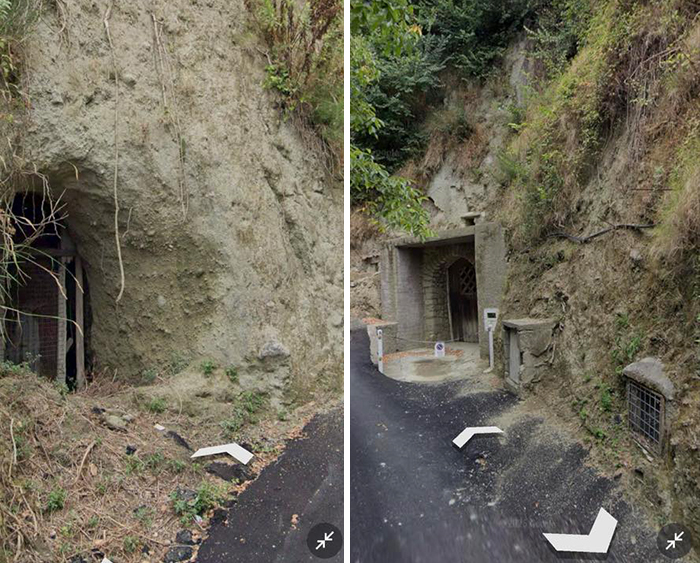
#25 I Did Not Know An Italian Island Has Real Hobbits Who Live In The Ground In Real Hobbit Holes
© Photo: Anonymous participant
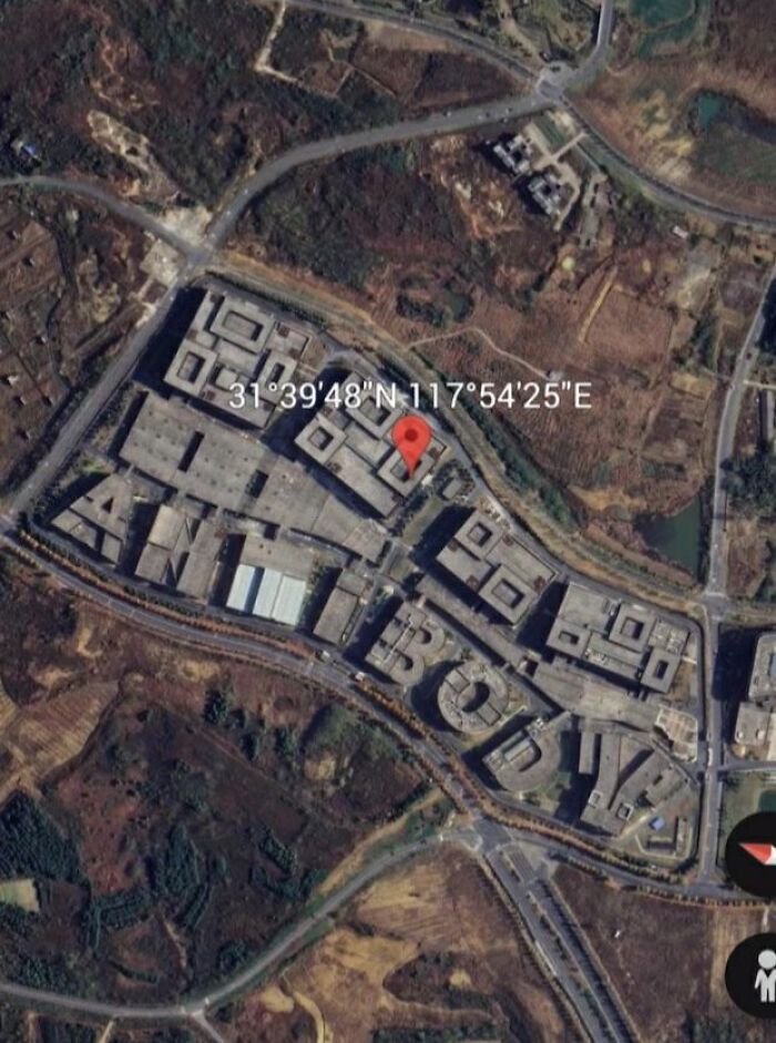
#26 Found Some Buildings In China Spelling Out The Word Of "Antibody"
Here is the coordinates, you can check on every maps like google, bing, baidu etc. 31°39'48"N,117°54'25"E Or this coordinate for apple maps user, you can copy and paste this: 31,66330°N, 117,90704°E *Ps these images are not photoshopped or AI Generating, they are for real. You can check it by yourself
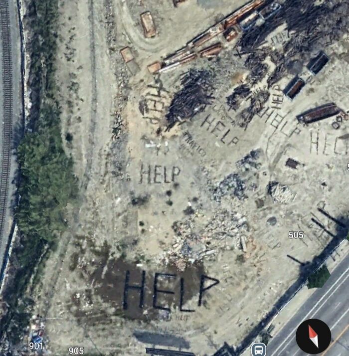
#27 Unsettling Message Spotted On Google Earth Near Cesar Chavez Ave, La: "Help," "Trafico," "Lapd," And "Federal" Written In Debris Coordinates: 34°03’17.8”n, 118°13’32.2”w
© Photo: Roddy
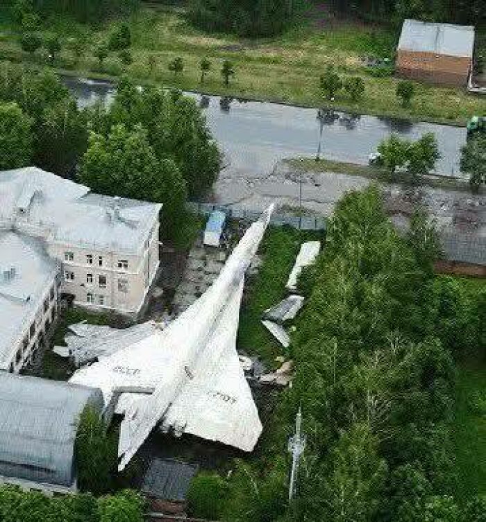
#28 Tupolev Tu-144 "Concordski" Russian Concorde Why Would Someone Park A Tu-144 Supersonic Passenger Jet In The Middle Of Town? And Better Yet, Why Would They Abandon It?
© Photo: Jacob Albert
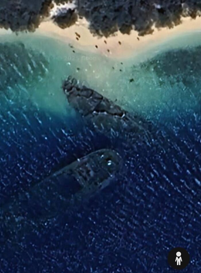
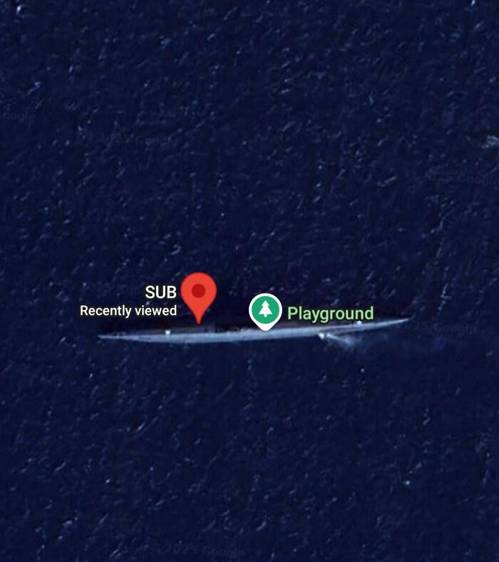
#29 Unknown Two Shipwrecks In Venezuela
© Photo: Leo De Sousa
#30 Best House Ever In Portsmouth NH.. Dude Still Lives There.. See If You Can Find It, Right Off The Highway
© Photo: Jamie Grant
#31 Playa De Los Muertitos La Paz B.c.s MX
© Photo: Jesús Sánchez Galindo
#32 On Google Earth In Pyongyang, North Korea
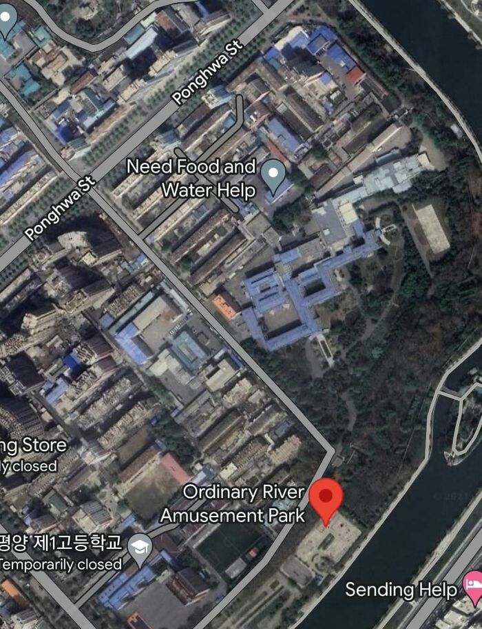
© Photo: 𝙆𝙤𝙣𝙖 & 𝙍𝙤𝙣𝙮
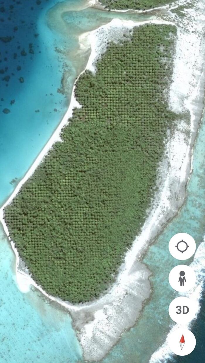
#33 Found This Weird Island, Anyone Know Why The Trees Would Be Laid Out In Such Straight Lines??
Obviously not impossible to do, but I don't know why anyone would put so much effort into planting a grid of trees on a random island
© Photo: Jacob Albert
#34 Go To Your Google Earth And Type Kent St. 44305 In Search And Click Street View You’ll See This Guy, Doing Whatever It Is He’s Doing
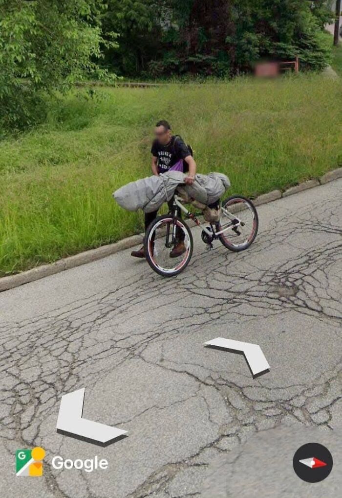
© Photo: Cinta Kuliner
#35 Stunning Formation In The South Of Algeria. I Wonder What It Is?
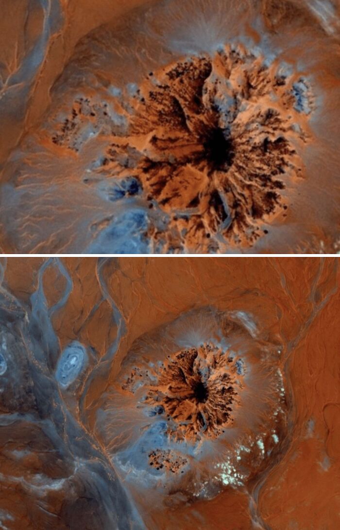
© Photo: Curt Junior
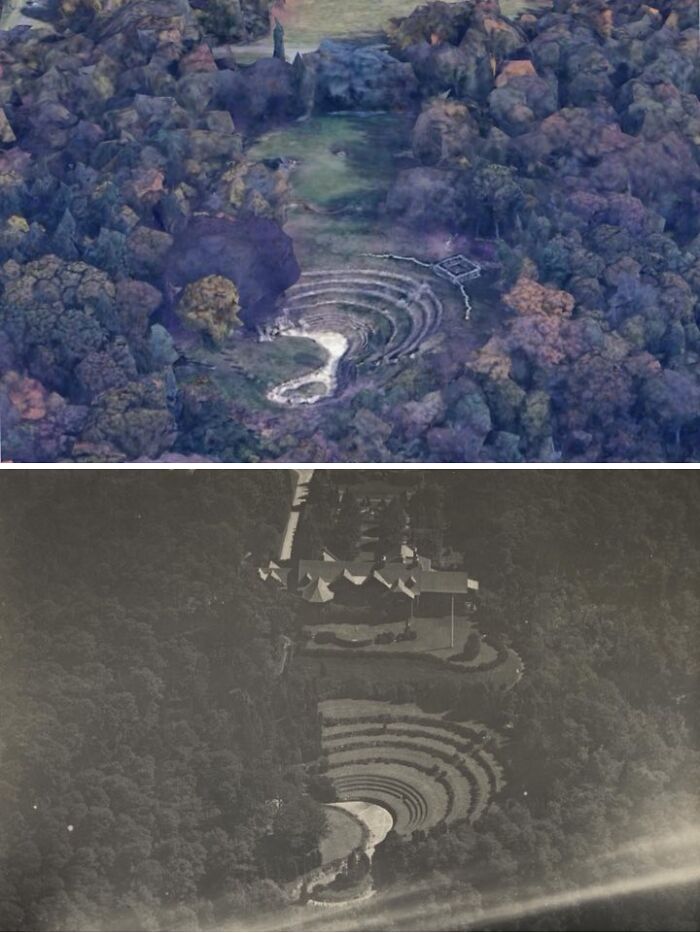
#36 Located In Lloyd Harbor, New York Is The Ruins To A 1907 Gilded Age Estate
In 1990, after years of it being unkept, the home caught fire by vandals and burnt to the ground. Today, the former entryway, amphitheater, and druid-inspired ruins remain. Recently they were restored and it’s a beautiful place to visit. But, very eerie knowing the grandeur that once was.
#37 Hm
© Photo: Pixie Loropetalum
#38 An Image Of The Face, Located At 50.010611, -110.113422 In Southeast Alberta, Canada
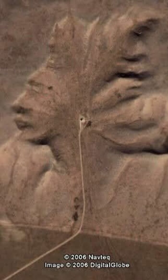
© Photo: James Raid
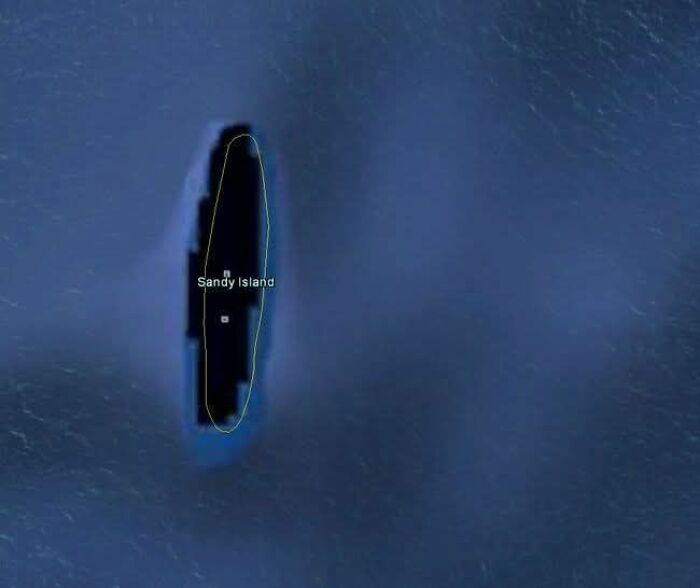
#39 In 2012, A Group Of Australian Researchers "Undiscovered" An Island The Size Of Manhattan In The South Pacific
A mysterious place called Sandy Island had popped up on maps, northwest of New Caledonia. It even showed up as a black polygon on Google Earth. But when scientists sailed there in November 2012, they found open water instead of solid ground.
© Photo: Putri Wulandari
#40 Person Riding A Horse In UK. 50°39'28"N 2°24'12"W
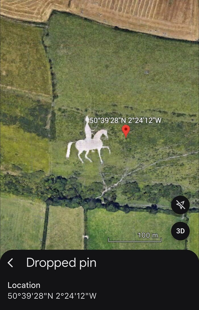
© Photo: Brian Proa
#41 Just A Small Sample Of Thousands And Thousands Of New Cars At The Port In Zeebrugge, Belgium
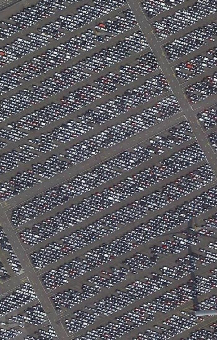
© Photo: Jim Connolly Jr.
#42 China, Mongolia, Made By The Hand Of Man, Why Or For What? I Don't Know
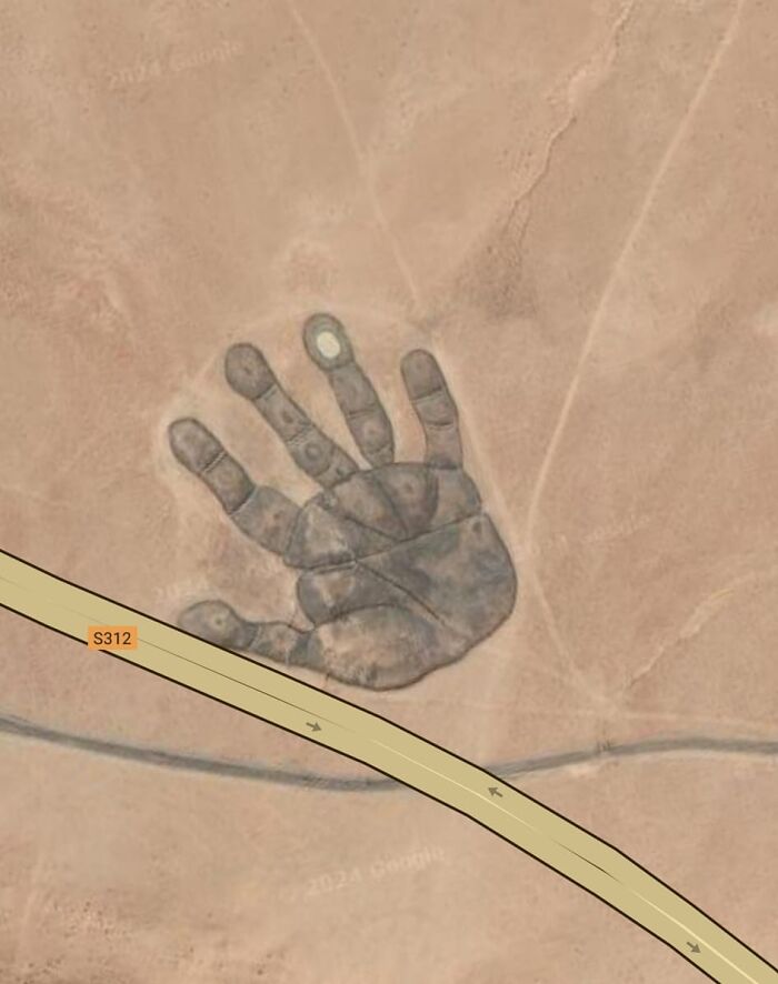
© Photo: Jacob Albert
#43 Below 34°41'18"N 139°26'14"E
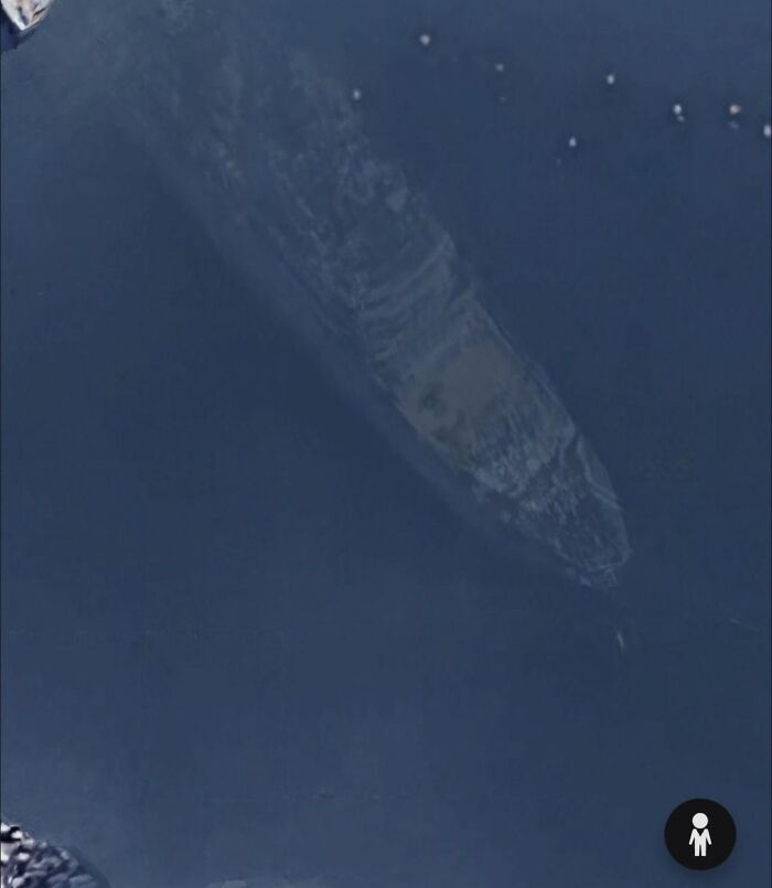
© Photo: Esmae Harding
#44 Somebody Knows What’s Behind Mount Rushmore? The Entrance Looks Like From A Mine But At That Position It Doesn't Make Sense To Me
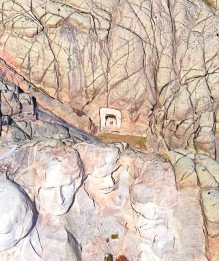
© Photo: Laila Puspa
#45 Embassy Of The Ottoman Empire In Pyongyang. North Korea Is Late
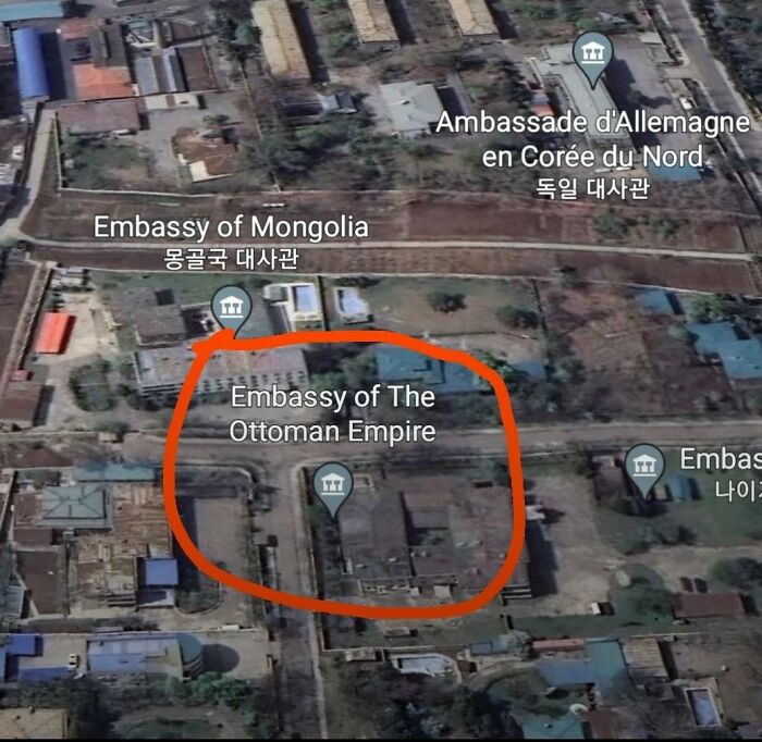
© Photo: Shalu Kumari
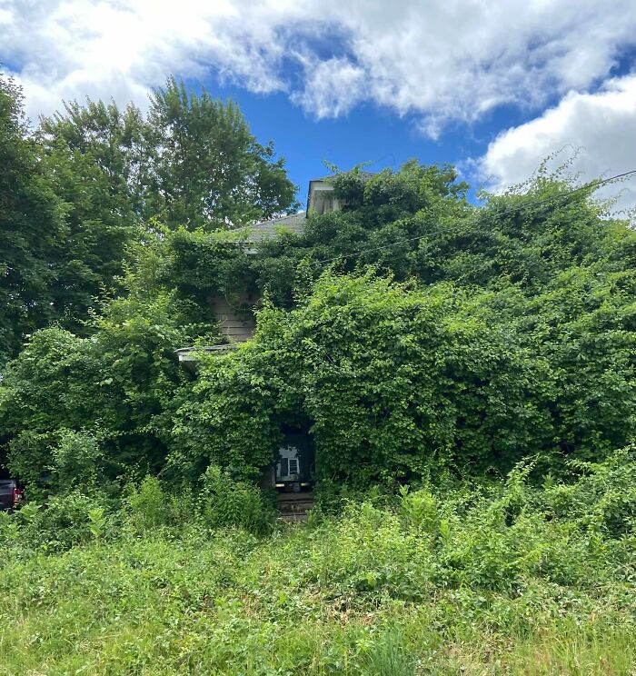
#46 Any Idea Why A Whole House Would Be Blurred? None Of The Other Houses On The Street Are And No Matter How You Come At It.. Its Blurred
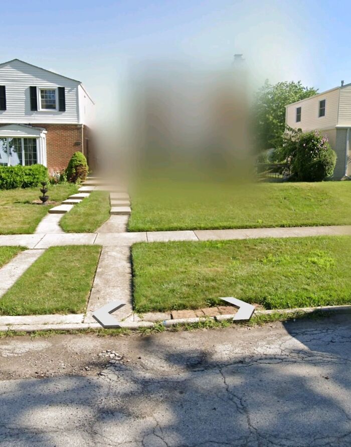
© Photo: Sarah Sorensen
#47 No One Is Talking
© Photo: Shareef Adan
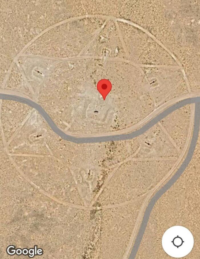
#48 Burning Man Festival. Black Rock City, A Temporary Community Built In The Black Rock Desert Of Northwestern Nevada
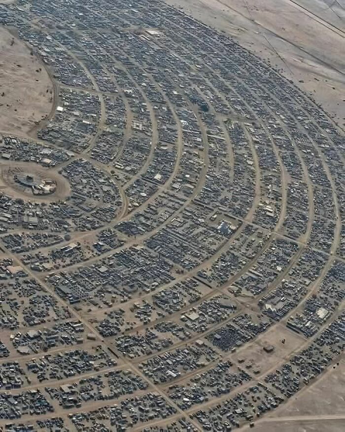
© Photo: Carissa Zie
#49 Boerne, TX
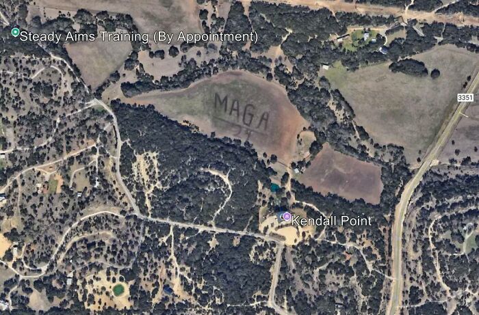
© Photo: Rohma
You might also like: 68 People Share Bizarre Facts They’ve Learned That Are Actually True
No comments