Photos Taken From ISS Show How Devastating The Australian Bushfires Really Are
Last fall brought catastrophic events in Australia that are still yet to be curbed. Over the course of several months, more than 100 fires have raged in the country. By the beginning of December, the wildfires in Australia’s New South Wales region had already scorched an area of approximately 10,000 square miles.
Today, the raging bushfires are so bad that the satellites from space can easily spot the flames and smoke coming from the Australian land. Now, the astronauts have begun tracking them from the International Space Station.
Hundreds of fires burning in multiple states of the country have already generated enough smoke to travel almost 7,000 miles away to Chile – news agencies have reported that usually cloudless skies in central Chile have turned hazy.
In New South Wales alone, the fire has claimed more than 1,500 homes and nearly five million hectares of land. The crisis has already taken 20 people’s lives and countless animals’ lives. In addition to this, Nasa Goddard Space Flight Centre reports that the “enormous pulse of CO2 from the fires was equivalent to almost half Australia’s annual greenhouse gas footprint.”
The Himawari-8 satellite photographs the Western part of the Earth once every 10 minutes
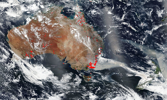
Image credits: NASA EOSDIS
Australia’s bushfires and their smoke plumes are now easily visible from space
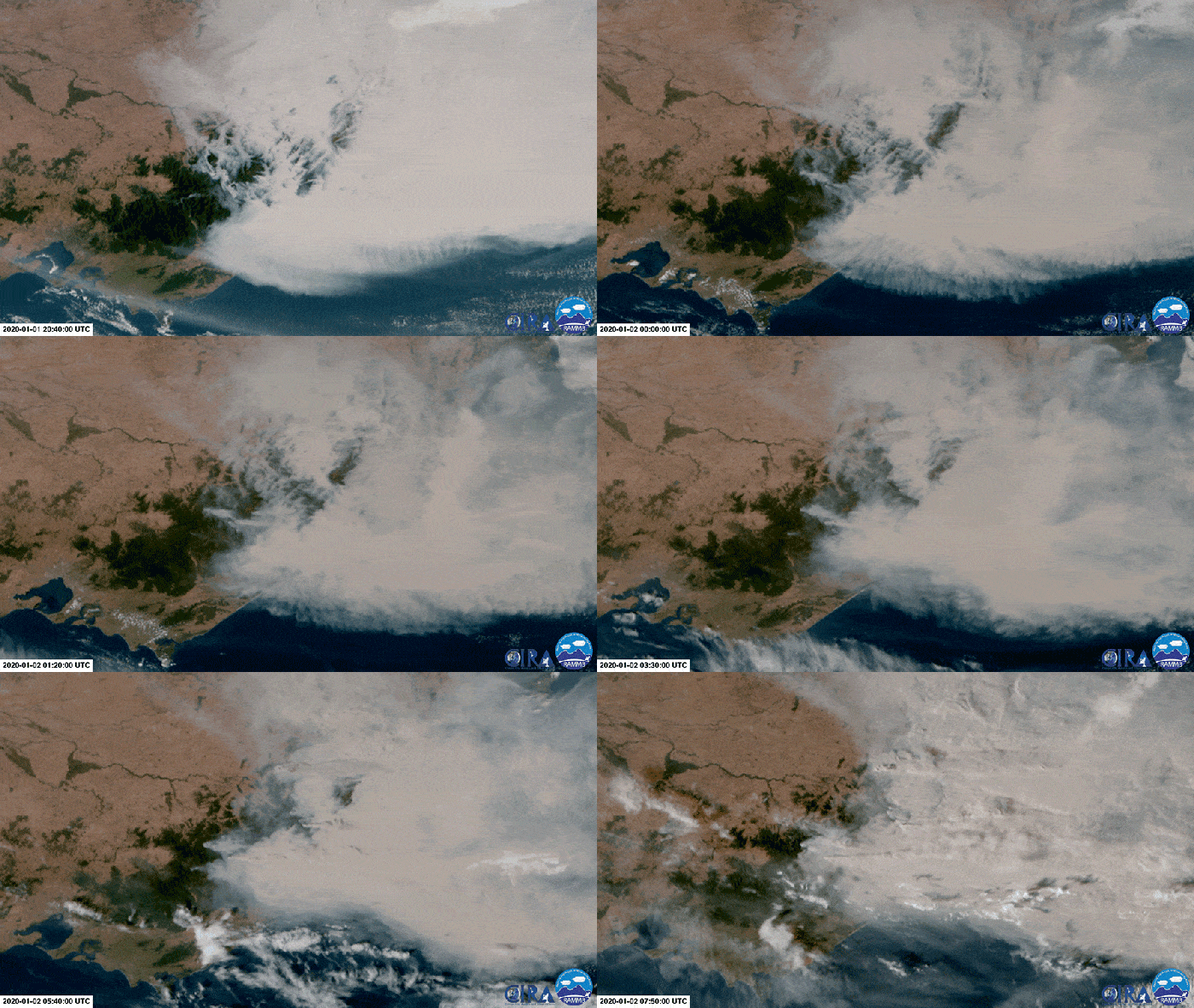
Image credits: NASA EOSDIS
After an abnormally long and expansive drought, the fires have spread over vast areas of the country
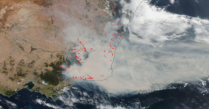
Image credits: NASA EOSDIS
It’s hard to wrap your head around the devastating scope of the fires
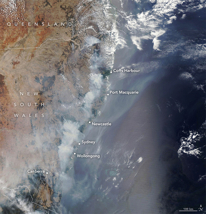
Image credits: NASA EOSDIS
The smoke plume is now the size of half of Europe
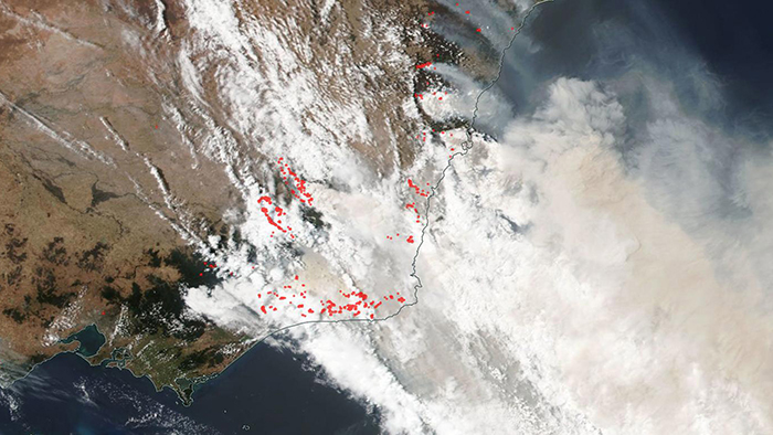
Image credits: NASA EOSDIS
And it’s traveling further, clouding up the skies in New Zealand and Chile
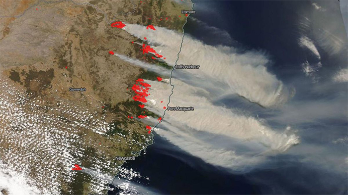
Image credits: NASA EOSDIS
As of January 6th, 69 of 136 fires burning across New South Wales are still not contained
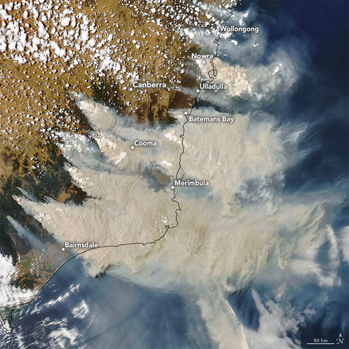
Image credits: NASA EOSDIS
Roughly 23,000 square miles of Australia have been burned
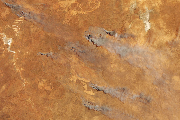
Image credits: NASA Earth Observatory
This satellite view of the fire in Bateman Bay, Australia was captured on New Year’s Eve
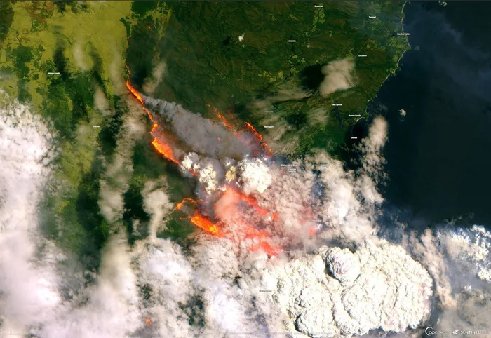
Image credits: RAMMB/CIRA/CSU
And this is the Himawari-8 satellite’s view of the bushfires and smoke clouds on January 2
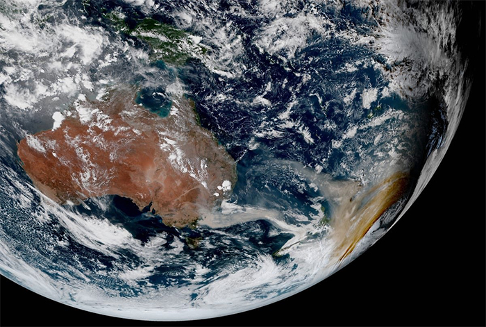
Image credits: NASA EOSDIS
Here’s a near-infrared view of eastern Australian hotspots of bushfires on November 7
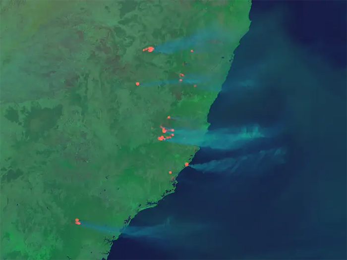
Image credits: RAMMB/CIRA/CSU
This is a comparison of the same area in July 2019 and January 2020
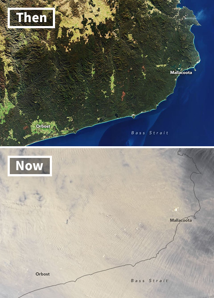
Image credits: NASA EOSDIS

Post Comment
No comments